Uncovering the facts
Learn about the research projects that are helping us to understand the challenges we face to rid the project area of pests
Predator movements
Knowing how introduced predators move and live across the landscape is helping us plan the best methods to remove pests and then keep them out of the 310,000 project area.
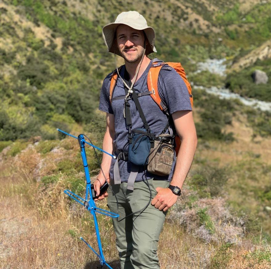
Over 2019 and 2020, a major study led by Otago University PhD student Nick Foster looked in-depth at the distribution and seasonal trends of stoats, weasels, possums, ferrets, hedgehogs, feral cats, Norway rats, hares and rabbits.
The Te Manahuna Aoraki Project area is bounded by 212 km of mountainous terrain. Nick then used the data to identify what mountain ranges and terrain will be effective at limiting, or preventing, the reinvasion of each predator species.
Over 2.5 million images from motion activated cameras were analysed. Nick has released a number of research papers. You can follow links below to read them. The results may surprise you.
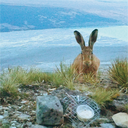
How high do they go?
READ THE FULL RESEARCH PAPER
European hedgehogs rear young and enter hibernation in New Zealand’s alpine zones
Hare today, gone tomorrow?
In a New Zealand first, 28 hares have been GPS collared and tracked for between 2 and 12 months over the course of two and a half years.
We want to know how far, and where, hares range in the alpine areas. Final results from this research will be extremely valuable for the management of hares in the project area and New Zealand-wide.
In high numbers, hares cause significant damage in sub-alpine and alpine grasslands as they graze on sensitive populations of native plants. Hares are also a food resource for introduced predators like feral cats and stoats, and support populations of predators in areas where they can also prey upon natives like tuke/rock wren and kea.
How far do they roam?
We wanted to know how high small invasive predators like hedgehogs, feral cats and stoats range in the mountains? We even fitted hedgehogs and hares with GPS transmitters to track their movements.
Watch the video about Nick’s research into predator movements.
High-altitude fence trial
While the high mountains in the project area will act as natural barriers to stop pests reinvading, our research shows some of the lower mountain ranges can be “leaky”.
That means we may need to erect pest-exclusion fencing in a few places. To see how they stand up to the extreme weather conditions, we are trialling three different predator-proof fence designs at Mt Hay Station in the Two Thumb range.
HIGHEST WIND GUST RECORDED
197.4km/hr
Recorded on 1/12/2019
FENCECAM
Below is the latest image from Fencecam, which updates every 30 minutes.
Please note, refresh your page if you have looked at this previously to load the new image. Also, because the camera is solar-powered, updates may be less frequent during sunless periods.
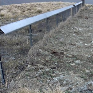
Fence designs
These three fences were designed with input from landowners and Zero Invasive Predators (ZIP). A webcam and weather station are monitoring conditions.
DESIGN A
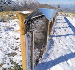
- Short, strong, proven design
- 1.1m high
- PPF cap with wooden posts at 2m centres
- 12m long
DESIGN B
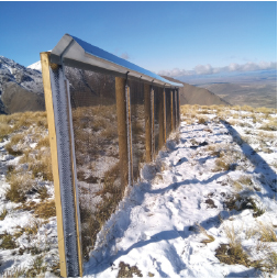
- Tall strong, proven design
- 1.8m high
- PPF cap with wooden posts every 2m
- 12m long
DESIGN C
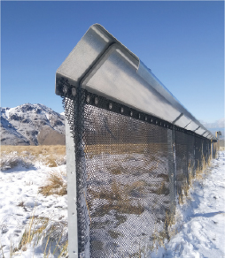
- Short novel design
- 1.1m high
- PPF cap (plan to trial HDPE cap)
- 12m long + wooden end posts
- 57 irons every 2m
Tracking tarapirohe/black-fronted terns
A study using GPS trackers on tarapirohe/ black-fronted terns is revealing more about their daily movements.
Unlike most terns which are seabirds, the tarapirohe lives and breeds inland, only visiting the coast to feed in autumn and winter. While they are seen quite often there’s a big knowledge gap about how far they travel from their colonies and which habitats they prefer spending time in.
In November 2021 Lincoln University Master’s student Fraser Gurney attached trackers to 34 birds in the Cass and Upper Ōhau rivers. This is the first time trackers have been put on this species. Te Manahuna Aoraki, Project River Recovery and DOC are supporting this work.
Canada geese movements
Canada geese live on high-country waterways in summer, before heading to breeding grounds in the headwater valleys of rivers flowing from the Southern Alps in spring.
The project has attached GPS radio collars to a number of Canada geese to track their movements over an 18-month period. This will help determine how effective Canada geese culls are, and also provide information about where the geese move to, so we can work with other runholders in the Mackenzie Basin to humanely reduce geese numbers across the region.
Historical research
Other research in the project area has laid the foundations for the Te Manahuna Aoraki project. Here are a few of the most interesting ones.
This study identified the most significant predators of three species of ground-nesting birds – kakī/black stilt, Tarapirohe/black-fronted tern, and turiwhatu/banded dotterel. It involved five years of videoing, and back in 2002, when the study was undertaken, that involved carting cameras and motorcycle batteries around riverbeds.
This study by Otago University student Mariano Recio attached GPS trackers to feral cats. It has developed our understanding of feral cats’ massive home ranges and habitat use.
READ THE RESEARCH
Misinformation tactics protect rare birds from problem predators
It’s great to see the many different ways researchers are looking to protect endangered species. In this case ‘fake news’ was used to help wildlife. Researchers protected endangered birds by spreading misinformation – in the form of bird smells – to deceive predators.
Photo credits: Nick Foster, Robyn Janes
